- Overview
- Trip Outline
- Trip Includes
- Trip Excludes
- Gallery
- Reviews
- Booking
- FAQ
Highlights
- Experience the views and spirits of Himalaya, especially from Everest Base Camp and Kala Patthar
- Cross three best high passes of the world in the Everest region: Renjo La (5,340m/ 17,520 ft), Cho La (5,420m/17,782 ft), and Kongma La (5,535m/ 18,159 ft)
- The trail comes along the most travelled route but will also makes you leave the crowd in many points
- Enrich your experience with your trekking experience with monasteries and locals (especially Sherpa Villages)
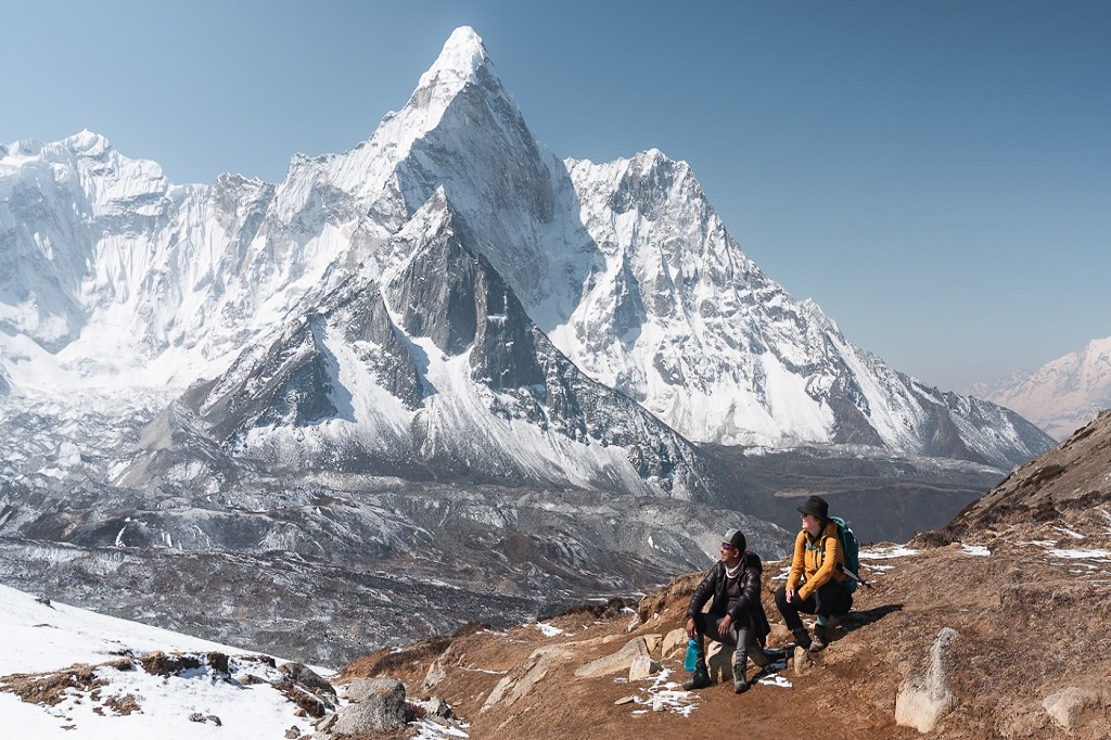
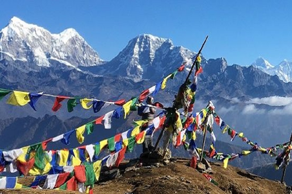
- Amazing views of peaks including Everest, Ama Dablam, Cho Oyu, Lhotse, Nuptse and many more
- While the route may not always have wildlife, you still have small chances on spotting snow leopard but will witness plentifull of Thar, and yaks
Facts
Days: 18 days
Region: Everest (Solukhumbu)
Trip grade: Challenging
Best season: Fall and Spring
Maximum altitude: 5,546m/ 18,190 ft
Trek Distance: 175 km
Activity:Trekking
Permits: Sagarmatha National Park Permit, TIMS Card
Details
“A challenge for being near the Everest for 17 days”
The Three Passes Trek, also known as the Gokyo Three Passes or Gokyo Lake Trek, is one of the most challenging yet rewarding adventures in the Everest region. This trek takes you across three major passes: Renjo La (5,340m/17,520 ft), Cho La (5,420m/17,782 ft), and Kongma La (5,535m/18,159 ft) offering you breathtaking panoramas of iconic peaks, including Everest, Lhotse, Nuptse, and Ama Dablam.
It combines the thrill of high-altitude trekking with cultural immersion, making it a truly unforgettable journey. Why many trekking lovers choose this trek is also because it gives the opportunity to explore less-traveled corners of the Everest region, providing a sense of solitude and adventure. Not only this, it also gives chances to encounter the unique Sherpa culture, visiting monasteries, gompas, and experiencing local traditions.
While the olden days had camping necessary, you will find tea houses along the route, providing a basic but comfortable place to rest each night.
Is this trek for you?
This trek is demanding and requires a good level of fitness. Expect to walk uphill and downhill for more than 8 hours a day over the course of 17 days.
Ensure you are in excellent physical condition, prepared for long days of trekking. Perhaps experience of other short hikes and treks could prepare you more for this one.
Detailed Itinerary
Day 1: Arrival in Kathmandu
Highest Altitude: 1350 m
Welcome to the land of Nepal. As your flight lands at Tribhuvan International Airport, our representatives will escort you and your stuff to your designated hotel in Kathmandu. Rest, freshen up, and explore Thamel, the tourist hub of Kathmandu. You must also make sure that you are well prepared for the trek, including proper shoes, equipment, clothes, and others. It is better if we get to brief you on the itinerary before the trek begins.
Day 2: Kathmandu to Lukla (2,800m/ 9,187 ft) Flight and Trek to Phakding (2,860 m/ 9,184ft)
Flight Time: 40 minutes
Trek Time: 2-3 hours
Trek Distance: 9 km
Highest Altitude: 2,860 m/ 9,184 ft
Flights to Lukla are only open early in the morning so prepare to skip your sleep early in the morning. Have some breakfast and rush to the airport with us. You must make sure you have more days to your visit as these flights have higher chances of getting cancelled because of the unstable weather.
Rest a bit in Lukla as the preparations are being made. Shortly, we will walk through the Pasang Lahmu Sherpa Memorial Gate, taking a hike towards Phakding for the night.
Day 3: Phakding (2,860 m/ 9,184ft) to Namche (3,440 m/11,283 ft)
Trek Time: 5-6 hours
Trek Distance: 12 km
Highest Altitude:3,440 m/11,283 ft
Today we will have a lot of activities including crossing suspension bridges, having an uphill and downhill walk, and also a few walks across the Dudhkoshi river as well as through the blooming rhododendron forest.
From the village of Bankar, you will get a close view of Thamserku. Today we will enteras we walk oass the entrance at Monjo. Today we will also cross the Hillary bridge, one of the longest suspension bridges in the trail, named after the first climber of Mt. Everest, Edmund Hillary.
Jorsale is the last village before Namche where we can have our breakfast. With a few hours of hiking from here, we will reach Namche Bazzar, the Sherpa town– a tourist hub within the Sagarmatha National Park. This is one of the advanced towns where you can also find good hotels, meals, and ATM Service.
Day 4: Acclamatization day at Namche (Hike to Everest View Hotel)
Trek Time: 4-5 hours
Trek Distance: 9km
Highest Altitude: 3880 m/ 12,730 ft
To avoid altitude sickness, we must acclimatize in Namche Bazaar. The best day to spend the day is to trek to the Everest View Hotel. This spot offers breathtaking views of mountains such as Ama Dablam, Everest, Nuptse, Lhotse, Thamserku, and Cholatse, as well as the village of Tengboche that will just take your breath away. Along the way, we will also pass by Syangboche Airport, which is considered one of the most dangerous airports in the world.
You have other options including the Khumjung village, which is just a short walk from the Everest View Hotel. Or, there are also nearby museums and monasteries you may choose to explore.
Day 5: Namche (3,440 m/11,283 ft) to Tengboche (3,860 m/ 12,660 ft)
Trek Time: 4-5 hours
Trek Distance: 9.2 km
Highest Altitude: 3,860 m/ 12,660 ft
We will be rewarded with breathtaking vistas during the first portion of the walk, which is also rather easy. We will then hike downhill to Phunke Tenga, walking past yet another dense, rhododendron-filled forest. We will then walk past Phunke Tenga and arrive at Tengboche.
Tengboche is a beautiful settlement with famous cafes and Tengboche Monastery which is one of the oldest monasteries in the Khumbu region. Tengboche will have a magnificent view of Ama Dablam as well.
Day 6: Tengboche (3,860 m/ 12,660 ft) to Dingboche (4,410 m/14,464 ft)
Trek Time: 5-6 hours
Trek Distance: 11 km
Highest Altitude: 4,410 m/14,464 ft
The day begins with a downhill trek through a dense forest, providing ample shade until we reach the Imja Khola, a tributary of the Dudh Koshi. After crossing the bridge, we'll hike uphill to the village of Pangboche, which offers stunning views of Ama Dablam and the surrounding landscape. Here, we'll also see a gompa and the Buddhist Mani Wall.
After traversing several hills, we'll arrive at Dingboche. This village features numerous chortens, horse stables, and shops to explore.
Day 7: Acclamatization Hike to Chhukung Ri (5,546m/ 18,190 ft) and Trek to Chhukung (4,730m/15.514 ft)
Trek Time: 4-5 hours
Trek Distance: 6 km
Highest Altitude: 5,546m/ 18,190 ft
Taking on the task of a day hike beyond the route, we will hike up the Chhukung Ri (5,546m/18,190ft) and then descend down to Chhukung for the night.
Chhukung Ri has an awestrucking view of numerous mountians including the clear views of Amadablam, Thamserku, Island Peak, Lhotse, and Makalu. Heading to Chhukung, the trail will not be that easy. With a rocky and unstable walk and crossing Imja Khola you will reach Chhukung. From here, the trail can sometimes be steep and the uphill walk can take upto 5 hours of your attitude to finish this difficult challenge. But it all will be worth it with the beautiful views of the snow-peaked mountains, named and unnamed. Enjoying the view as you take a rest, we will soon have to descend again back to Chhukung.
Day 8: Chhukung (4,730m/15.514 ft) to Lobuche (4,910 m/ 16,105 ft) via Kongma La (5,535m/ 18,159 ft)
Trek Time: 6-7 hours
Trek Distance: 9.6 km/ 14 km
Highest Altitude: 5,535m/ 18,159 ft
Today is the day you will walk through one of the three high passes: Kongma La (5,535m/ 18,159 ft) which is also the hardest among the three. We will head to the Pokalde Base Camp on a small rocky trail and around hillsides. We will also see a lake which is just below the pass that we will climb. In about 4 hours, we will finish climbing Kongma La. Enjoy the view and descend towards Lobuche for the day.
Fun Fact: Lobuche is the second-highest village on the trail of EBC.
Day 9: Lobuche (4,910 m/ 16,105 ft) to Gorakshep (5,130m/16,830 ft) and Hike to Everest Base Camp (5,364 m/ 17,594 ft)
Trek Time: 8-9 hours
Trek Distance: 12km
Highest Altitude: 5,364 m/ 17,594 ft
The walk will be on a rocky trail towards Gorekshep today aiming to reach the Everest Base Camp. From Gorekshep, you will get challenges like strong wind, cold temperature but it all is indeed worth it with the view of Khumbu Glacier along the way.
Everest Base Camp will have a beautiful view of the surrounding peaks but a reminder that Everest is not visible from here. Mount Everest can be enjoyed from Kala Patthar tomorrow. After enjoying the heart’s content, we will trace our way back to Gorakshep for the night.
Day 10: Early Hike to Kala Patthar (5,545m/ 18,188 ft) and Trek to Dzongla (4,830m/ 15,939 ft)
Trek Time: 10 hours
Trek Distance:14.5 km
Highest Altitude: 5,545m/ 18,188 ft
Wake up early before the light hits your face. We will take a hike to Kala Patthar with a torch light in hand. Upon arriving at Kala Patthar, you will need to be ready for the stunning views of the sunlight coloring the snowcapped canvas. We will take a moment to appreciate these beautiful views including that of Mount Everest.
Descending down to Gorakshep, we will quickly have our breakfast and pack our bags as the day will be longer till sunset as we head to Dzongla.
Day 11: Dzongla (4,830m/ 15,939 ft) to Thangnak (4,750m/15,580 ft) via Cho La (5,420m/ 17,780 ft)
Trek Time: 7 hours
Trek Distance: 8 km
Highest Altitude: 5,420m/ 17,780 ft
Today we will take a steep ascent through a rocky ridge, around glaciers and crossing the glacier streams that will take you to the pass with Lobuche west looming around us. Climbing rockstairs to meet the chola Glacier, and soon walk to the top of it. Reaching the top of the pass, you will have beautiful views of Ama Dablam, Kangtega, Thamserku, Tarboche, Cholatse, Baruntse, and more!
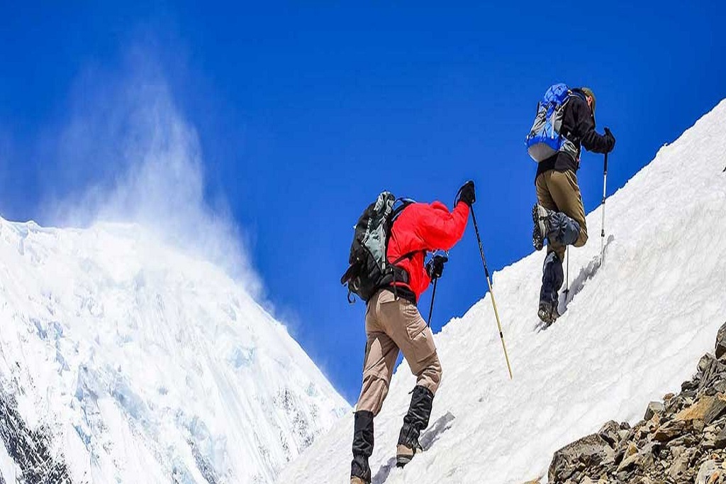
Be careful on tracing your way down the pass as the trail is rocky, icy, and slippery.
Today’s stop will be Thangnak (4,750m/15,580ft) for the night.
Day 12: Thangnak (4,750m/15,580 ft) to Gokyo (4,800m/15,744 ft)
Trek Time: 4 hours
Trek Distance: 4 km
Highest Altitude: 5,840m
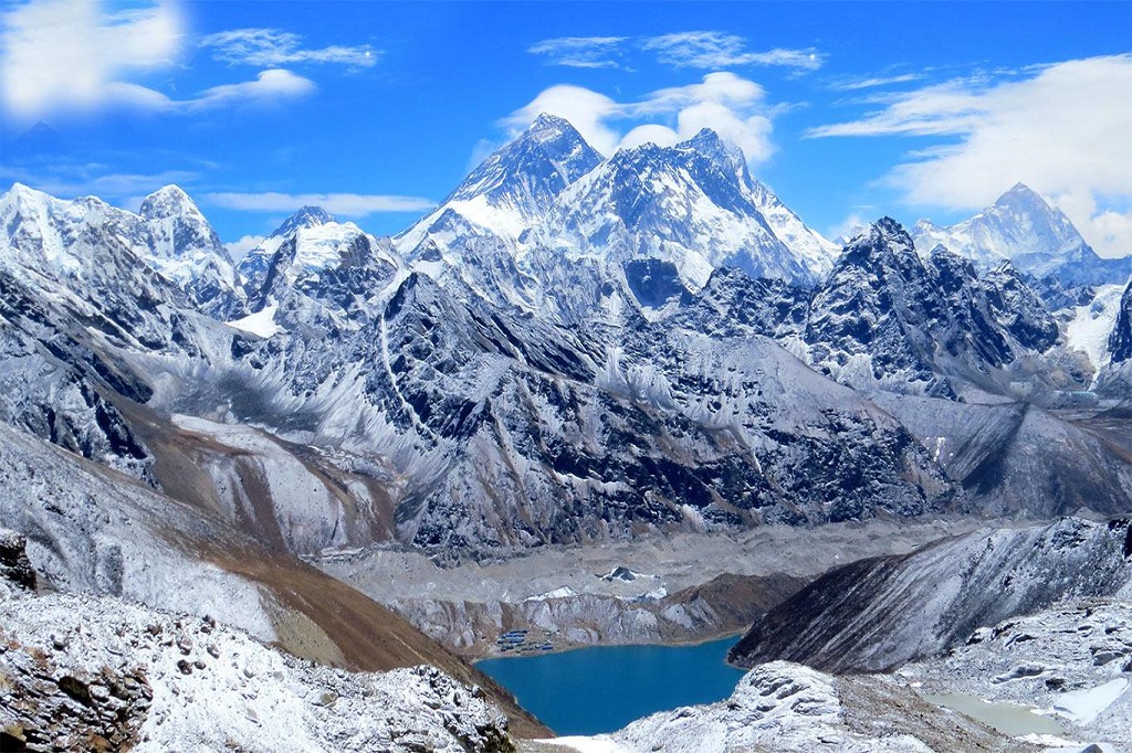
Today’s early morning walk will take you through Ngozumpa Glacier and the path will make us pass through first and second gokyo lake. By the third lake, we will reach the Gokyo village with a view of Mt. Cho Yu.
If you still have time, explore the glacial morine, lakes, else, you can just rest and enjoy the view just fine from your hotel room.
Day 13: Explore Gokyo Valley and Hike Gokyo Ri (5,357m/ 17,570 ft)
Highest Altitude: 5,357m/ 17,570 ft
Today is all about exploring, including the remaining lakes of Gokyo as well as the Gokyo Ri that holds the finest panoramic view of the himalayan oddessy. Beyond the fifth lake, there is also Cho Oyu Base Camp giving sceneric view of Cho oyu and Gyachung Kang.
Find your trekking route for the day and enjoy. Ending the day, we will make our way back to the Gokyo village for the night once again.
Day 14: Gokyo (4,800m/15,744 ft) to Lungden (4,370m/14,334 ft) via Renjo La (5,360m/ 17,580 ft)
Trek Time: 8 hours
Trek Distance: 14 km
Highest Altitude: 5,360m/ 17,580 ft
Wake up and enjoy your breakfast with the wonderful view you have here. Today's early walk will include to the west of the Gokyo Lake towards Renjo La (5,360m/17,580ft). The walk will be through sandy ridge, streams, and with the views of Makalu. Upon reaching the top of Renjo La we will find another gorgeous view of the 7000+ m and 8000+m peaks. The trail to climb down would be difficult from here with the icy and slippery trail if you are here with no crampons and trekking stick. Finding views of Renjo lakes we will slowly descend to Thame Valley and then to Lungden where we will rest for the night.
Day 15: Lungden (4,370m/14,334 ft) to Namche (3,440m/ 11,287 ft)
Trek Time: 7 hours
Trek Distance: 18.3 km
Highest Altitude: 4,370m/14,334 ft
There will be an icy stream following the Bhote Koshi past Marulung and then Taranga village that will lead our trail. The trail wil have stunning views of Thamserkhu, Kathanga, Kusum Kanguru and more peaks along with a Gompa on the trail in Thame with three big images of Chenresig, Guru Rimpoche, and Buddha Sakyamuni. If you are here in May, you can enjoy the Mani Rimdu festival here.
Then we will head towards Samde anbd come across the world’s biggest hydroelectric power station as soon as you walk past the check post. Then we will reach Phurte village which has Laudo monastery to explore .
Walking further we will eventually reach Namche where we will be staying overnight.
Day 16: Namche (3,440m/ 11,287 ft) to Lukla (2,800m/ 9,187 ft)
Trek Time: 11 km
Trek Distance: 8-9 hours
Highest Altitude: 3,440m/ 11,287 ft
Today, we will have an easy walk as we will mostly have a downhill walk. We will cross forests, landscapes, and villages to reach Lukla where all of this adventure once began. We will rest here for the night, and might as well celebrate the end of the trek.
Day 17: Morning flight to Kathmandu
Flight Time: 40 minutes
HIghest Altitude: 2,800m/ 9,187 ft
The flight is only availabe early in the morning as said. Hence, we will take the morning flight to Kathmandu. Take a rest, explore the streets of Kathmandu and especially of thamel, take the day for relaxing at a spa and do not forget to buy sovinuers.
Day 18: International Departure
Highest Altitude: 1,350 m/ 4,430 ft
The day you bid your goodbye to Nepal, we will assist you one last time with luggage and even provide transportation for your international departure. Make sure to be prepared to reach the airport 3 hours beforehand.
Include and Exclude
PACKAGE INCLUSIVE:-
- Transportation
- National/ International airport pickup and drop with private transportation
- Kathmandu-Lukla-Kathmandu flight tickets
- Accomodation
- Twin sharing room of a 3 star hotel of Kathmandu with breakfast.
- Tea houses./ lodge during the trek
- Documentation
- Sagarmatha National Park permit and TIMS Card
- All other necessary documentation process
- Meals
- Three meals per day (Breakfast, Lunch and Dinner)
- fruits during dinner (apples, oranges, etc)
- Farewell dinner with Nepali cultural programs
- Trekking region services
- Duffel bag, sleeping bag
- Licenced, experienced, English speaking guide
- Assistant guide for group with 6+ trekkers
- Porterto help with your bags (2 trekkers: 1 porter)
- Travel & rescue arrangement
- First aid box with guide all the time
- Others
- Transprotation, insurance, salary, food and accomodation of entire staff
- Trekking achievement certificate.
PAKAGE EXCLUDED:-
- International airfare
- Travel insurance
- Nepal entry visa
- Lunch and dinner in Kathmandu or other city areas
- Additional Days than mentioned in the itinerary
- Additional costs due to delays caused by health, weather, or other circumstances
- Extra facilities in trekking region ncluding:
- phone calls, wifi, battery recharge,
- Laundry
- bar bills
- extra porters
- bottle or boil water
- Alcoholic and non-alcoholic drinks
- Tips for guides, porters and drivers (they are expected)
- Any other expenses than mentioned in the inclusive list
No details found.
No details found.
No details found.
No Details Found

There are no reviews yet.